Macey Lakes
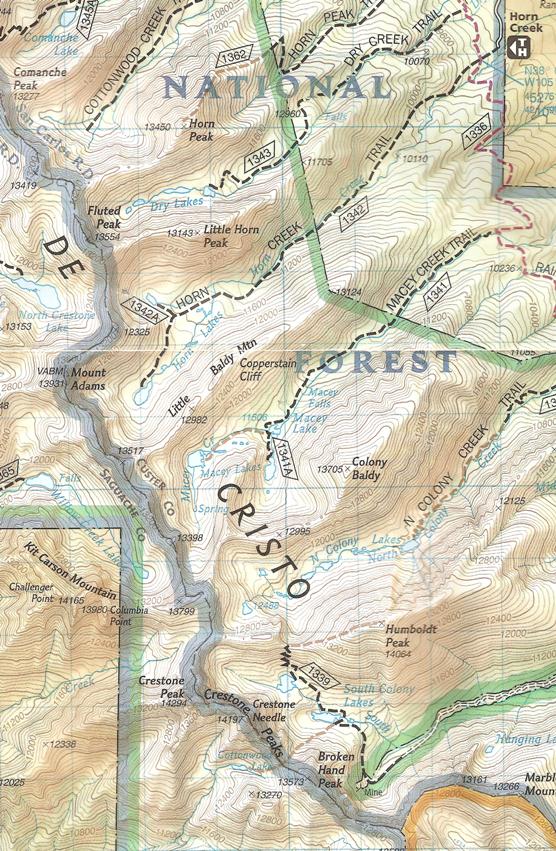
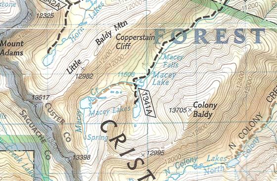
To begin this autumn trip to the Sangre de Cristo Wilderness, I camped on my land for a night. I woke up early in the morning and drove the remaining 45 minutes to the Horn Creek trailhead (see topo map below). To get back to the Macey Lakes you spend a couple miles on the Rainbow Trail (red dashed line) and then take the Macey Creek Trail back into the wilderness. There are three Macey Lakes (north, south, and west), and my mission on day one was to get to the south lake. (For the record, Sept. 14th was at the land, Sept. 15-17th were at the lakes, and Sept. 18th was back at the land. The year was 2012.)
Google map of Macey Lakes. (View Larger Map)
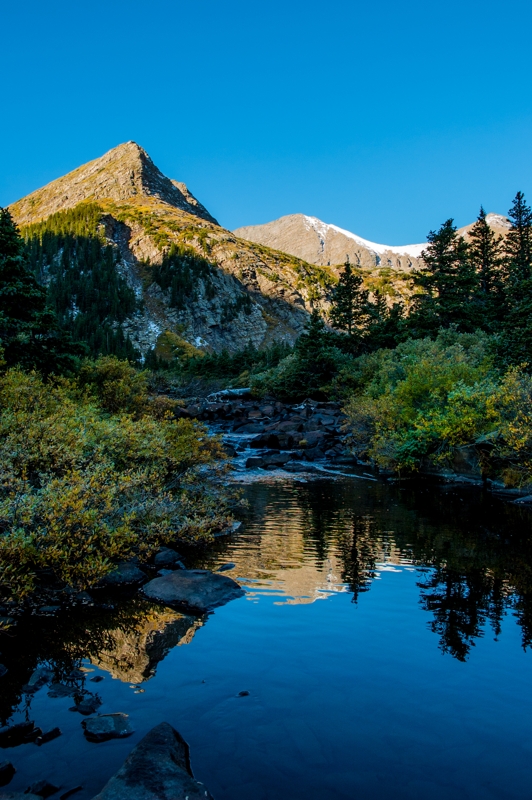
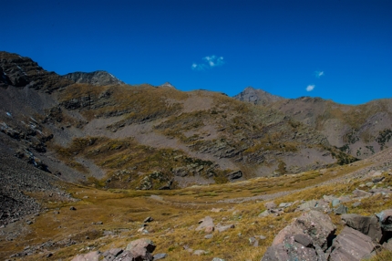
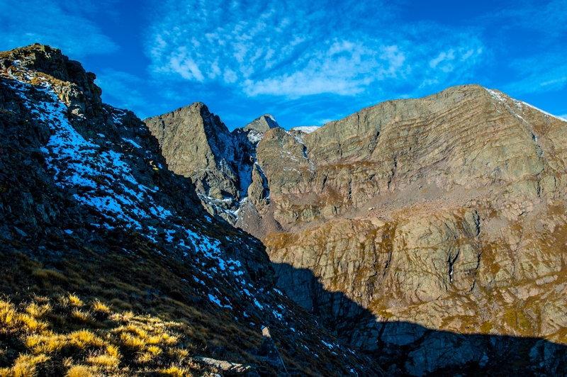
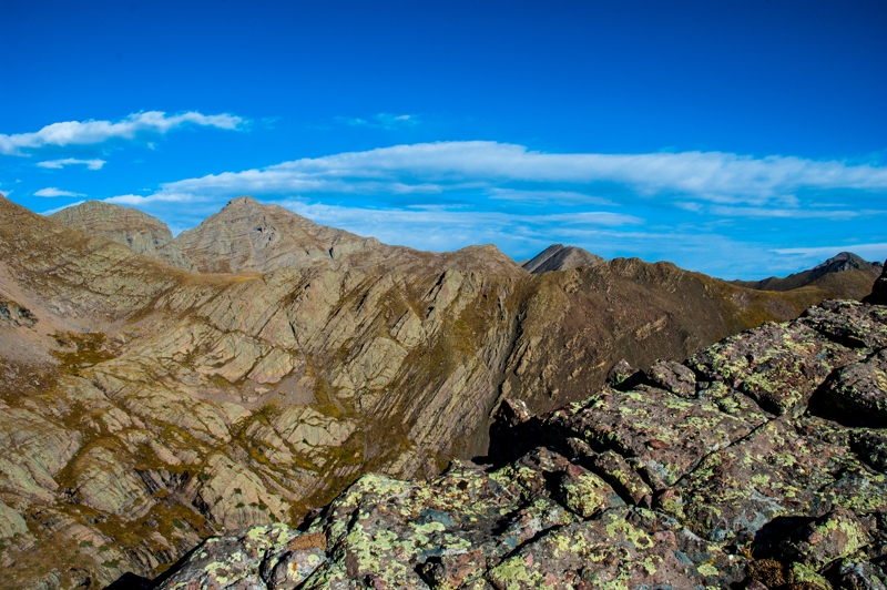
I stopped at the north lake to eat lunch and take in the views. The images below are of Macey Creek and the area near the north lake.
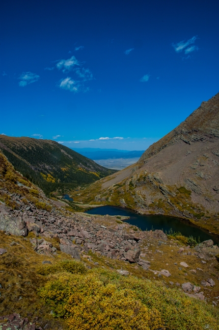
Notice in the above image there is a saddle on the far side of the lake. This is the route to the south lake. After resting for a few, I threw my pack back on and hiked that saddle. It is actually a really beautiful section with cascades running through it. At the top you enter the basin where the south lake pools. This view is shown in the image at the right.
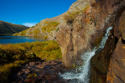
I hiked to the far side of this lake, sent up my tent, and got some water near this waterfall. The area is home to tons of pika, marmot, deer, fish, and birds of prey. There was a fair amount of what looked like moose scat as well as fox scat, but I didn't see any from bear or cougar. Here are a few more pics from this basin.
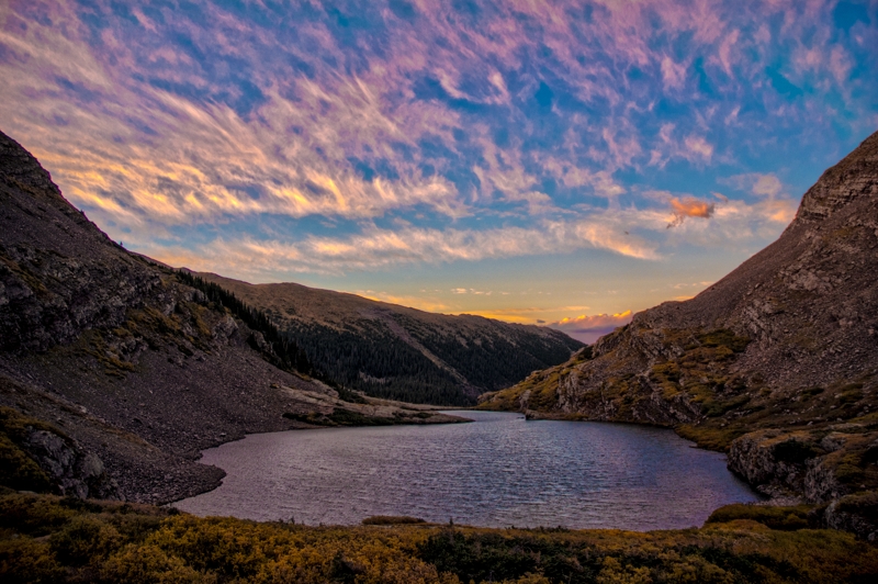
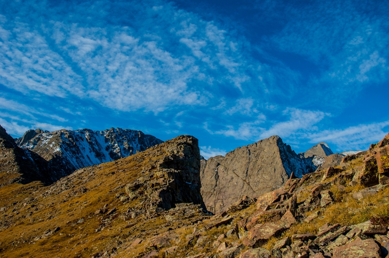
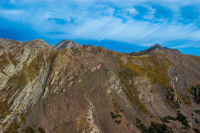
The southern wall of the basin at sunset.
The view east from south of the southern lake.
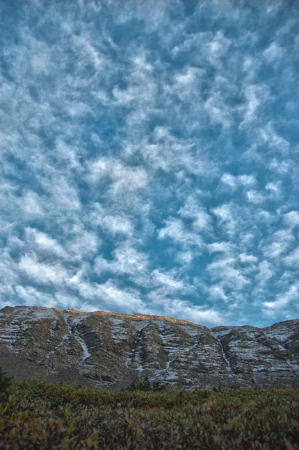
I witnessed a couple great sunsets in this bowl. Here are a few images of those.
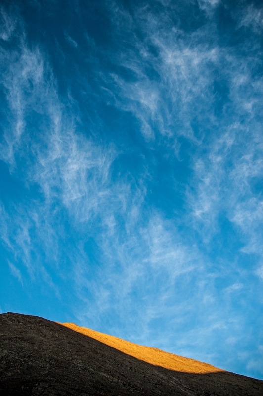

Here is a picture of the morning light catching the rocks.
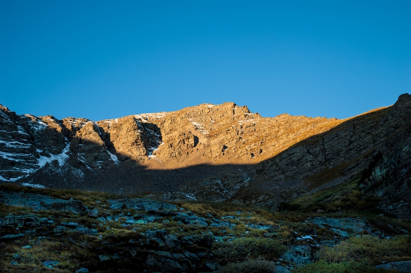
Southwest wall of the basin at sunrise.
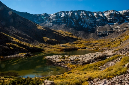
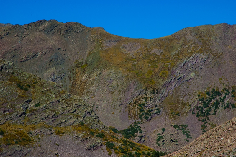
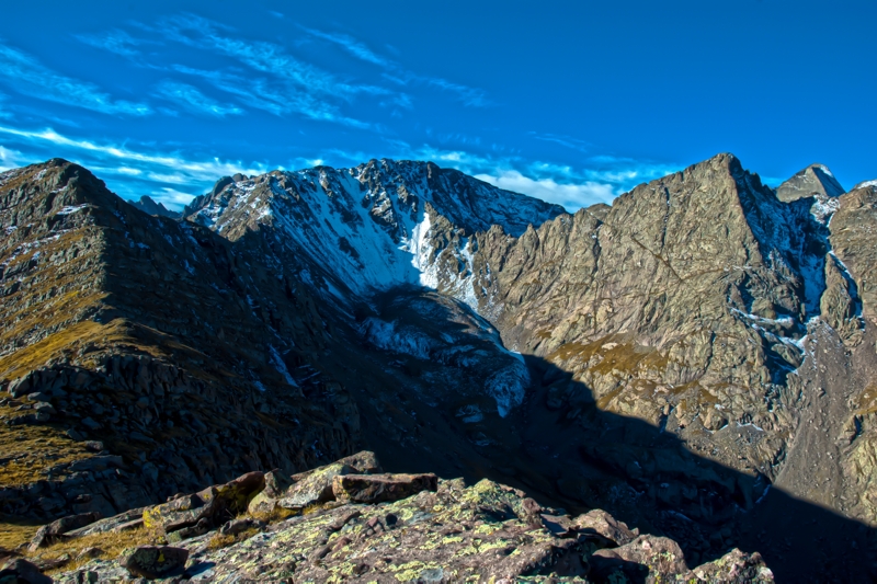
One of the reasons I wanted to camp at this spot was to hike Colony Baldy. I've read you can summit the peak by hiking the grassy slopes on the southwest face of the peak, and that the views of Humboldt Peak, The Crestone Group and Kit Carson Mountain are spectacular. Upon sizing up the situation I concluded there were no grassy slopes, and with only a few days until my siter-in-law's wedding, I decided to play it safe. After having traversed a wide stretch of the base of Colony Baldy in search of the promised grassy slopes, I decided to spend the rest of the sunny autumn day high up in the grass of the basin. I took some pictures and plotted my route up the opposite ridge for the next day.
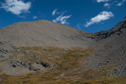
Southwest face of Colony Baldy.
Ridge opposite Colony Baldy, under "C" of Christo in topo map.
Beautiful patterns of rock and life near Copperstain Cliff.
Time lapse taken in the basin just below Colony Baldy. Notice the stone swirl on the distant hillside (also shown in the above image)—evidence that this stone was churned. I didn't take enough images in this sequence to observe the rock moving appreciably, but the clouds sure changed a lot.
A feature of the geology that is widely on display is what remains of the Sangre de Cristo Formation (a conglomerate); it is the rock that formed when the weather-worn stones of the Ancestral Rockies were cemented together with finer sand. These rock clusters speak across 300 million years. Here is a mass of the conglomerate happily and slowly eroding in a meadow.
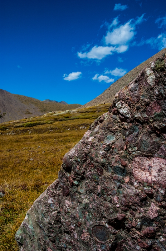
Chunk of the Sangre de Cristo Formation.
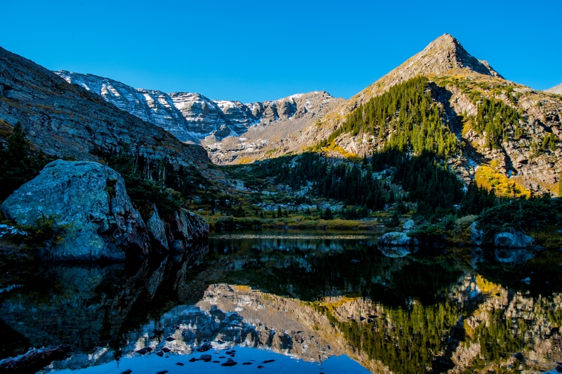
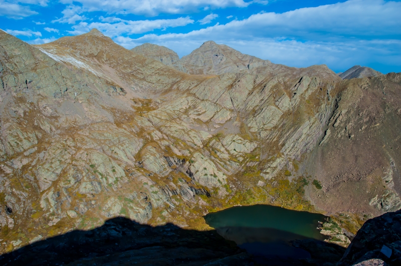
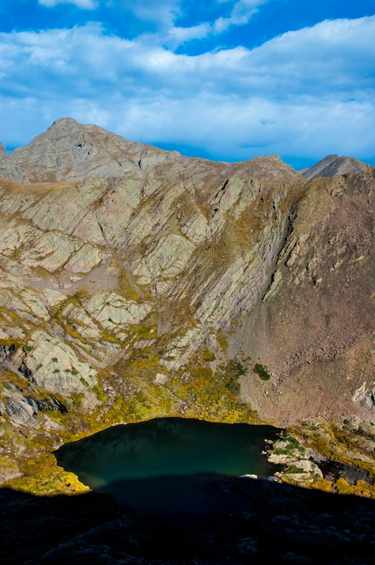
I started the next day with a hike to the ridge between the south and west Macey Lakes for views of the surrounding peaks and basins. Here are some of the images I came away with.
A view from the ridge between the south and west Macey Lakes. The prominent peak at the right is point 13,398 directly south of the western Macey Lake. The harmonizing triangular peak behind it is Challenger Point, part of Kit Carson Mountain. In the left of the image, the south wall of the basin of the western Macey Lake is visible, and behind it is the crest of Crestone Peak.
These mountains are enormous stones being chipped away by weight and weather, and every so often you hear a chunk get loose and fall down—crash and tumble, shatter and pool into these fine-grained fields of scree. To look at these vast piles of stones you have to ask how long it would take. At this rate (which is what? how many stones per year?), how long would it take to stack these ancient piles of smaller and smaller decomposing stones? Here in the Sangres, many stones are the conglomerate—evidence that however long it takes, the Earth has ground and entire range down, packed it dense, lifted the bedrock right up through it, and proceeded to grind again. The fact that all the conglomerated stones are so beveled speaks of a fair amount of time in Earth's washing machine.
A view looking northwest with point 13,517 on the left, Mount Adams behind it, and Fluted Peak behind Adams. Such a rich range. This image shows the basin of the western Macey Lake, where I would camp the third night, and the far wall which leads to point 13,517. This ridge definitely has some hikeable routes, and I'm sure the views over there are fantastic as well, but I wasn't able to squeeze that hike into this trip.
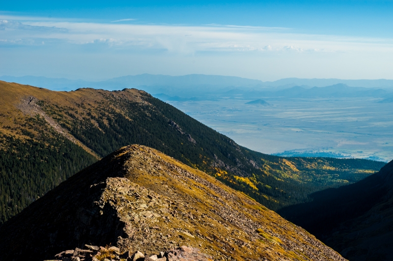
The view east with changing Aspen groves and the Wet Mountain Valley laying between the Sangres and the Wet Mountains. The Wet Mountains in the distance are the southern tip of the Front Range. The Wet Mountain Valley is one of the top five places on this particular planet.
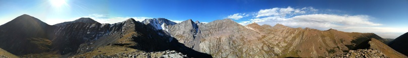
Panorama from the ridge. On the left is Colony Baldy with Humboldt Peak to its right. The basin on the left holds the southern Macey Lake, and that on the right holds the western Macey Lake (large version).
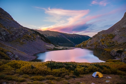
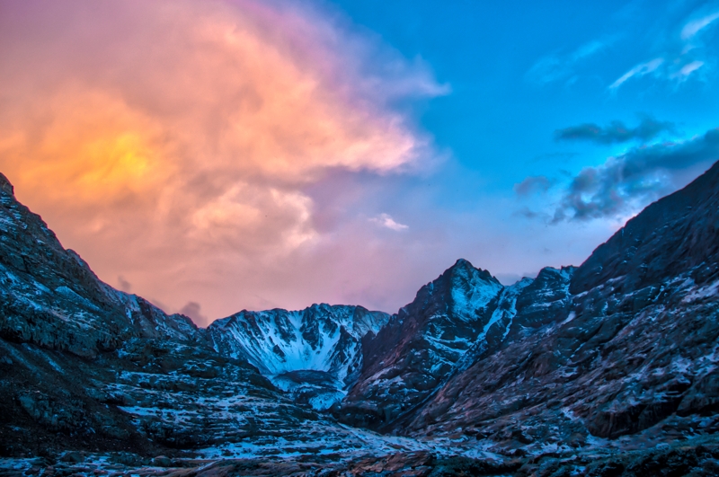
After coming off the ridge and packing up my stuff, I hiked around the ridge and to the west to set up camp in the adjacent basin. I was given enough time to set up camp before one of the first snowfalls of the year. It came down for about two hours, left a few inches, and most of it melted within fifteen minutes of the sun's return. Here are a few images I scrambled to snap as the clouds lifted after the snowfall.
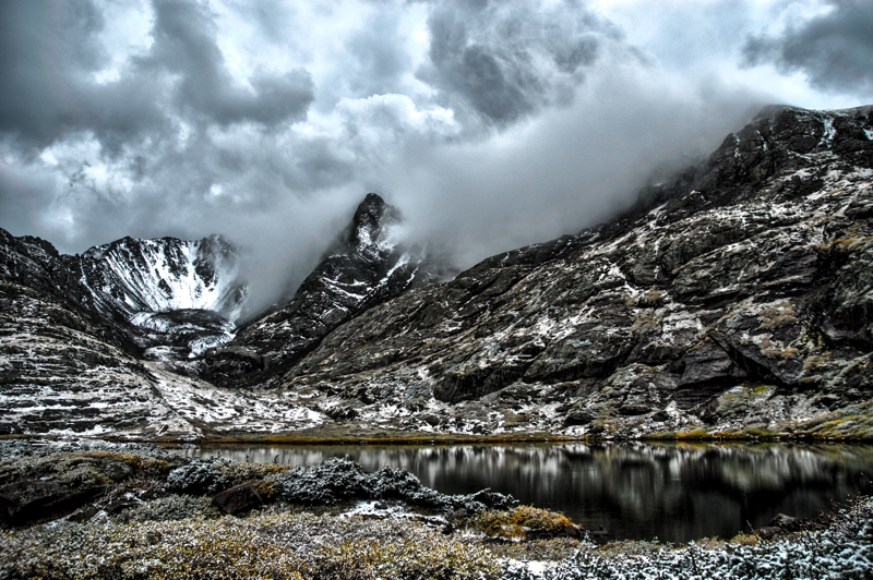
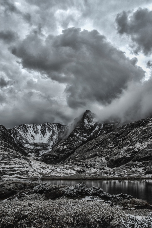
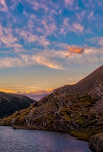
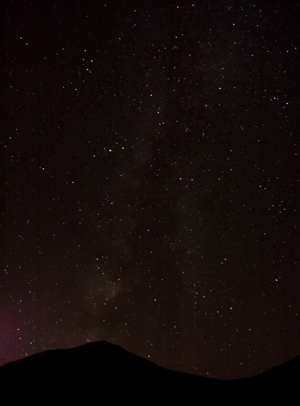
The weather left me blessed with dramatic and dynamic skies at sunset which then cleared for incredible views of the Milky Way.
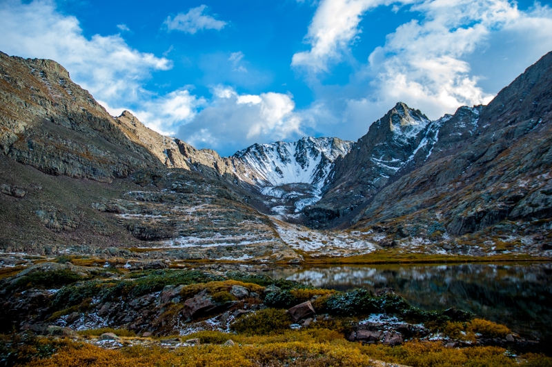
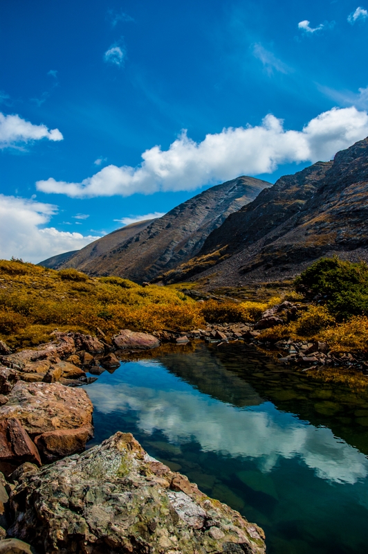
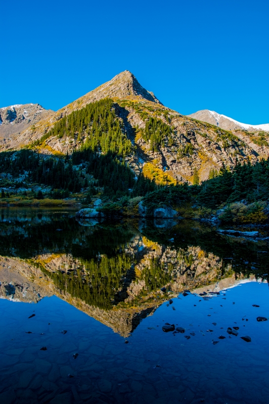
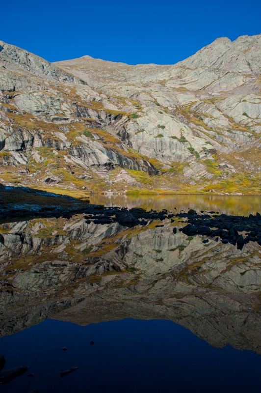
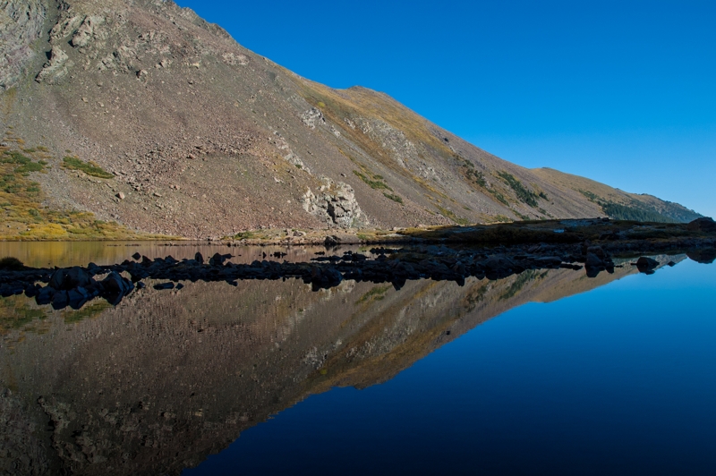
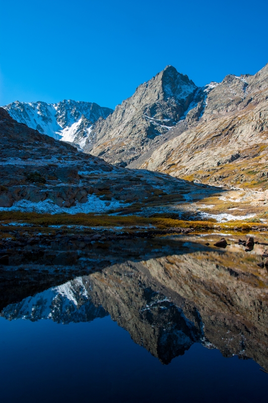
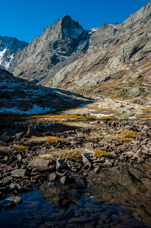
In the morning I had a bit of time to take pictures with a perfectly blue sky and relatively calm lake.

These are the light shows I witnessed in the roughly 24 hours I was in this basin. Imagine the scences in the last x million years of this basin's carving.
Finally, it was time to head east back to El Dorado. And what took six hours on the way in took 2½ on the way out. We have so much to thank gravity for.